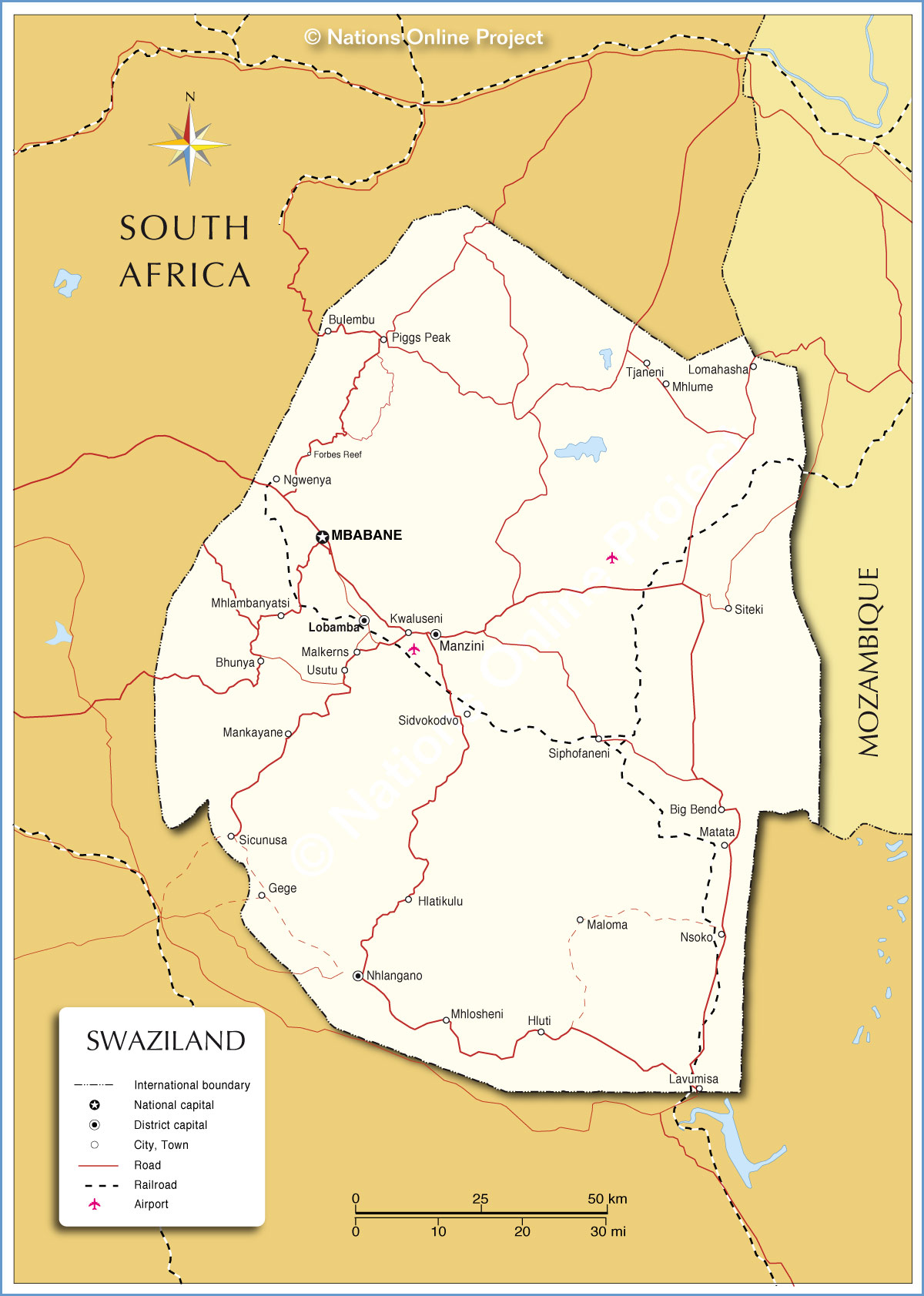
Detail Map Of Swaziland:
Swaziland, it is a country in Southern Africa. There are two capitals of Swaziland: Mbabane and Lobamba.
- Total area: 17,364 km?2;
- Population: 1.367 million
- Language: English
Swaziland Map
The Kingdom of Swaziland is a small landlocked country in eastern southern Africa, bordering Mozambique in the east and South Africa in the south. The country covers four regions: Hhohho (north), Manzini (Midwest), Lubombo (east) and Shiselweni (south).
Political Map of Swaziland
On political map, you can clearly see the main cities, provinces, borders and neighboring countries.
Travel Information Map
The Hlane Game Reserve is home to the largest game group in the country and is one of the few places in Swaziland where visitors can see lions, elephants and rhinos. The Mbuluzi Game Reserve offers a peaceful retreat on the banks of the Mlawula River full of crocodiles. The most popular activity here is the animal safari. Lobamba is the spiritual and cultural center of Swaziland. This relaxed city is home to the Swaziland monarchy and its main buildings. The cool capital of Swaziland, Mbabane, is home to the Swazi market, a must for tourists who are short of souvenirs. It is located at the southern end of the city's main shopping street, Allister Miller Street. Mlilwane Wildlife Sanctuary is one of the earliest protected areas in Swaziland and the most popular nature reserve. It was founded by Ted and Elizabeth Reilly who, with the support of King Sobhuza II, turned their farm on Mlilwane into a game reserve. The Mlawula nature reserve is located in a transition zone that stretches from the low grasslands to Mount Lebombo. The landscape here ranges from dry savannah to gentle green valleys to lush river forests. Mountains rise from south to north along the border with Mozambique.