Detail Map Of Kosovo:
An independent country in the Balkans called Kosovo. The capital of Kosovo is Pristina
- Total Area: 10,887 square kilometers
- Population: 1,831 million
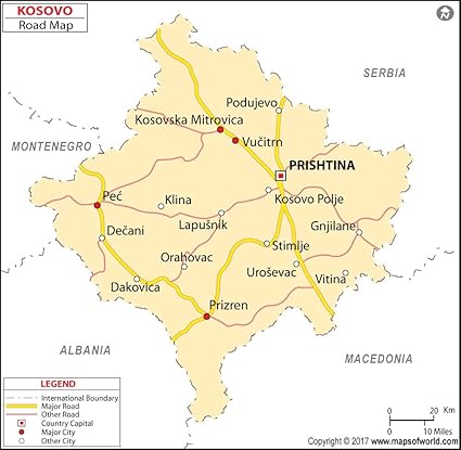
Kosovo Map
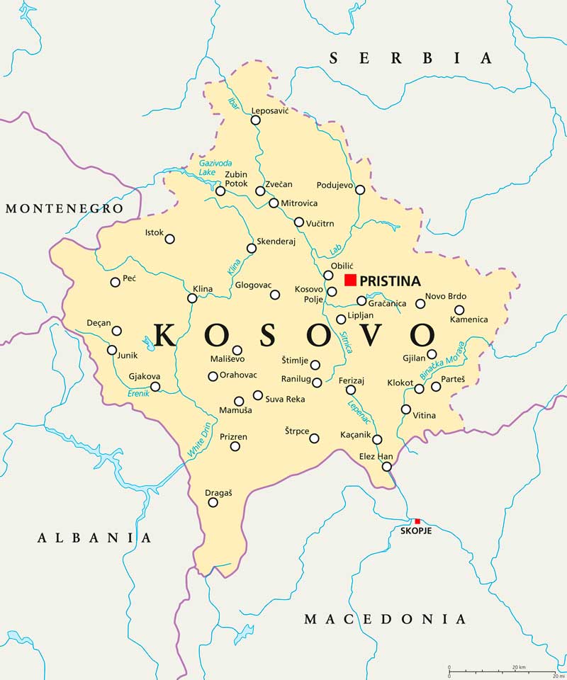
Kosovo is a landlocked country in south-eastern Europe, located in the Balkans, which has gained partially recognized independence from Serbia. The territory of Kosovo includes a central valley and a plain surrounded by high mountain ranges. The highest peaks in the east are located in the Prokletije Mountains, the height of the Dalavika peak exceeds 2600 meters, and the other two peaks also reach 2400 meters, namely the peaks Hajla and Veternik. The southern salt mountains extend almost to below 2400 m, while the summit of Mali I is 2392 m above sea level. The remaining mountain ranges are less than 2000 meters, with Kopaonik in the north and Goljak in the east. The central valley is filled with rivers, Sitnica is filled with the famous Kosovo oil field next to Pristina, White Drin drains the eastern plains, then turns south to Albania, Binacka Morava turns east to Serbia and the Ibar river leaves North Korea to the northern countries entered Serbian territory.
Political Map Of Kosovo

Political map of Kosovo with the international and regional borders of the country. The map also shows the locations of neighboring countries Macedonia, Montenegro and Serbia.
Places to visit in Kosovo
A national park in western Kosovo covers an area of 624.88 square kilometers. It was founded in 2013 to create a new tourist attraction in the country. Gazivoda lake, It is the largest lake in Kosovo. The lake was formed by a dam on the river Ibar. The lake is shared by Kosovo and Serbia. Its area is almost 12 square kilometers, of which Kosovo has more than 9 square kilometers and Serbia about 3 square kilometers.
Language in Kosovo
The Official Language of Kosovo is Albanian.